


On December 4th, 2023 a Tropical Disturbance (precursor to a Tropical Low) began over the central section of the Solomon Islands, north-west of Honiara. On Dec 5th it was declared a Cat 1 cyclone.
By Dec 8th the cyclone, now destined for the northern Australian coast, was Cat 4 and had been named "Jasper". It was now in the mid Coral Sea - it was moderately large, but slow-moving and carried a huge amount of moist air. Suddenly, on Dec 10, it began to accelerate, and more than halved it's distance from Cairns in 2 days. The city of Cairns and surrounds began cyclone preparations, but TC Jasper had not finished it's merry dance. It began to slow, and move slightly northwards, then, after an excruciatingly drawn out path, crossed the coast just north of Cedar Bay on the evening of Dec 13, as a Cat 2.
At first the residents from Port Douglas to Cairns, who were in the critical leading quadrant of the cyclone, thought it was largely a dud. Yes, it was windy, and yes there was plenty of vegetative debris, and a fair amount of rain, but damage was minimal. The cyclone, however, had not finished its story.
Many areas had lost power on the 13th, but mostly this was due to Ergon deliberately cutting the power for safety reasons. Further north, it was due to actual cyclone damage. Areas without power, soon also lost telecommunications. None of this was unusual in such circumstances, and most believed everything would be restored in a matter of a few days.
Slowly, in the aftermath of the cyclone, the winds again picked up and the rain began in earnest. From the 15th to the 18th of Dec, Wangetti was pelted with about 1.5 meters of rainfall. It was unprecedented, with many old time locals saying they had never seen anything like it. During the night of the 16th, the massive volumes of water caused enormous landslides along the Cook Hwy. The highway was cut in many places by rock and soil slides, and Wangetti was officially marooned.
To the south were many slides and overturned trees, but either side of Ellis Beach were two stupendous rock slides, and to the north, just past Turtle Cove an enormous small-house sized boulder had landed mid-highway. There was no escape up Quaid's Rd either, with rock/soil slides and many overturned trees blocking that route also.
For 7 days, there was no electricity in Wangetti, meaning for many, also no running water. Some had generators, but some of those generators stopped working early in the piece, and many were running very low on fuel long before the power returned.
The townspeople stayed optimistic and banded together. They shared what they had, and those with the appropriate equipment began to clear the highway and Quaid's Rd. There were some rescues made (some trapped tourists and campers), including some worn out wildlife, and largely the locals felt they had worn the brunt of the storm reasonably well. There was minimal flood damage, no one died or was injured, and eventually a food and fuel parcel was dropped by helicoptor early on Dec 20, courtesy of Douglas SES and QPS. Later that same day, an Ergon crew was airlifted into town, and after several hours of grid testing, power was restored. Never were so many, so grateful, to so few.
The highway was cleared enough, by the 22nd, to allow Wangetti residents to venture (under escort) to Cairns for supplies. The highway remained officially closed for the first few weeks of January 2024, with restoration works still ongoing a year later.
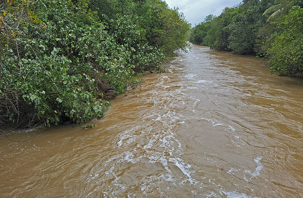
Hartleys in flood during TC Jasper (2023-12-14)
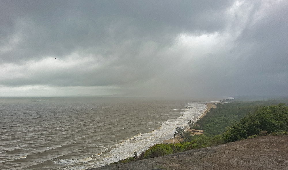
View from Rex Lookout on the afternoon after Jasper made land (2023-12-14)
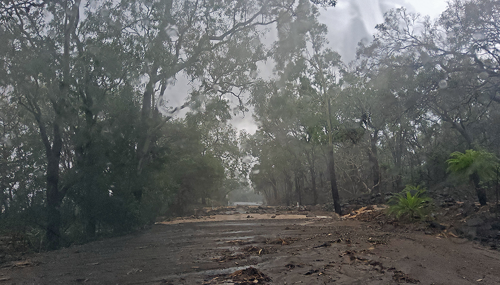
Damage on Captain Cook Hwy, to the south, from stream overflow (2012-12-17)
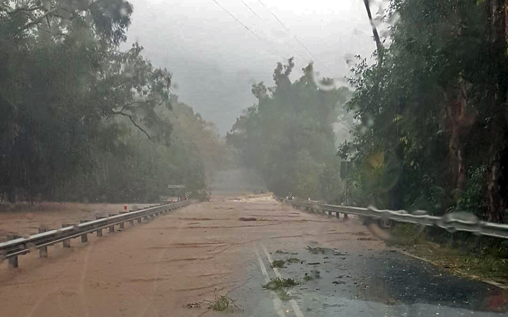
Hartleys Bridge goes under at midday (2023-12-17 photo courtesy M. Hollands)
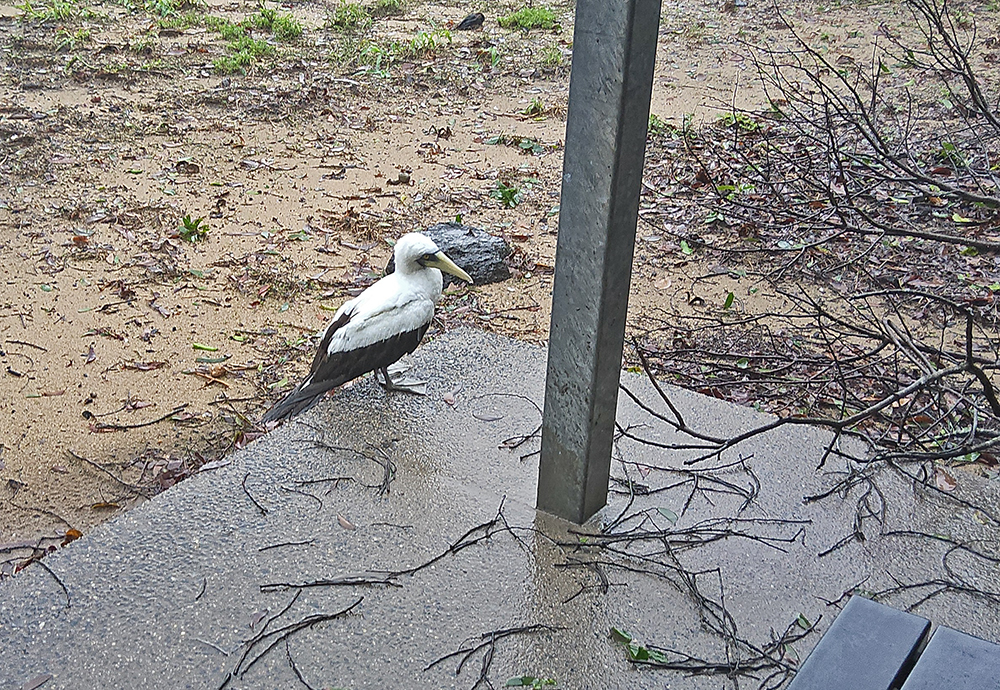
Half-drowned "Maxie" the Masked Booby - northern Wangetti carpark (2023-12-17)
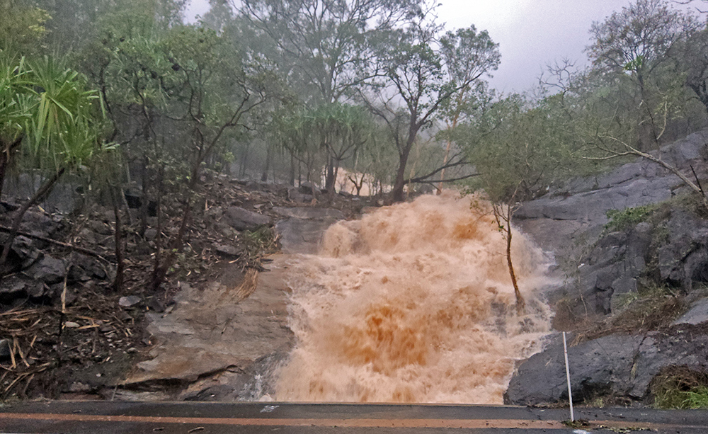
Seasonal creek in full flood (2023-12-17)
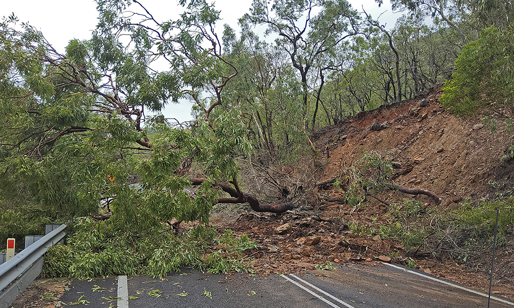
One of many large trees down over the Cook Hwy (2023-12-18)
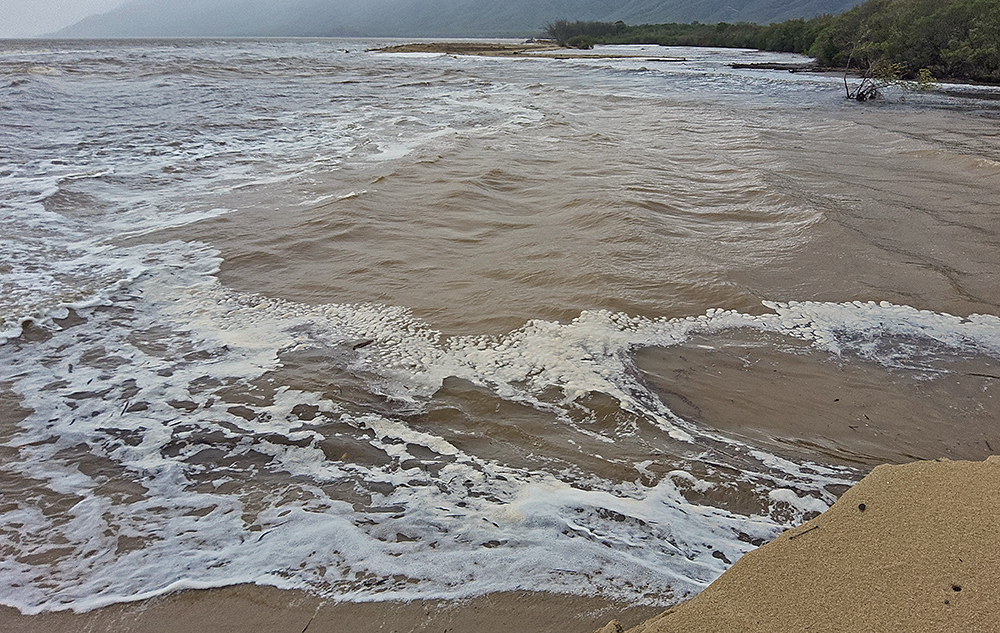
Hartleys 200m wide mouth (2023-12-18)
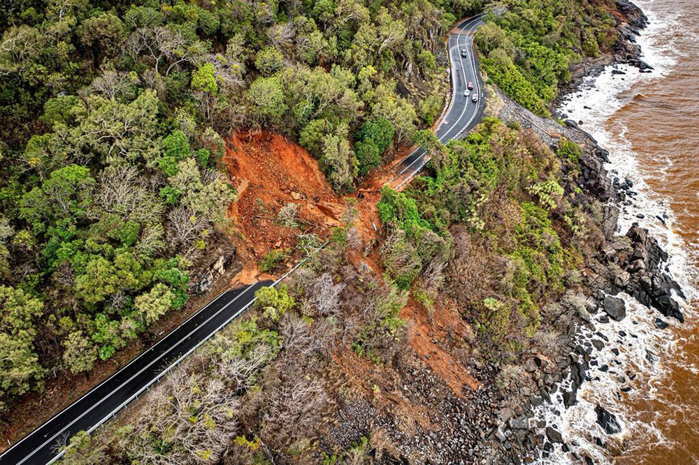
Aerial view of the large boulder landslide between Turtle Cove and Pretty Beach (2023-12-19)
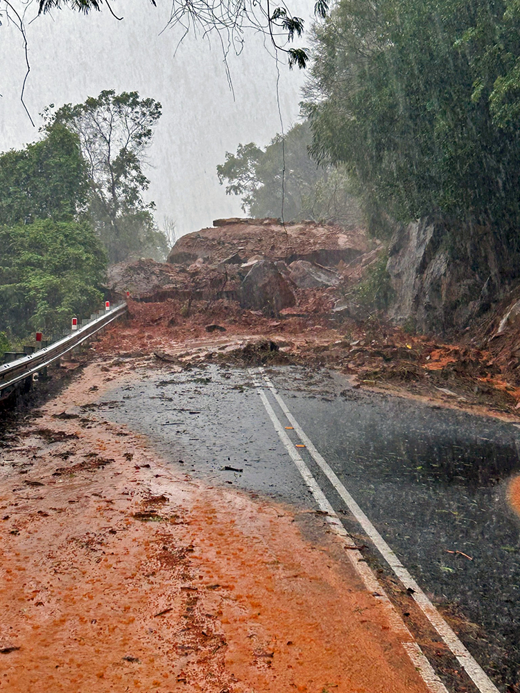
The "small house" sized boulder (2023-12-18)

The smaller of two great rockslides - this one to the north of Ellis Beach (2023-12-18)
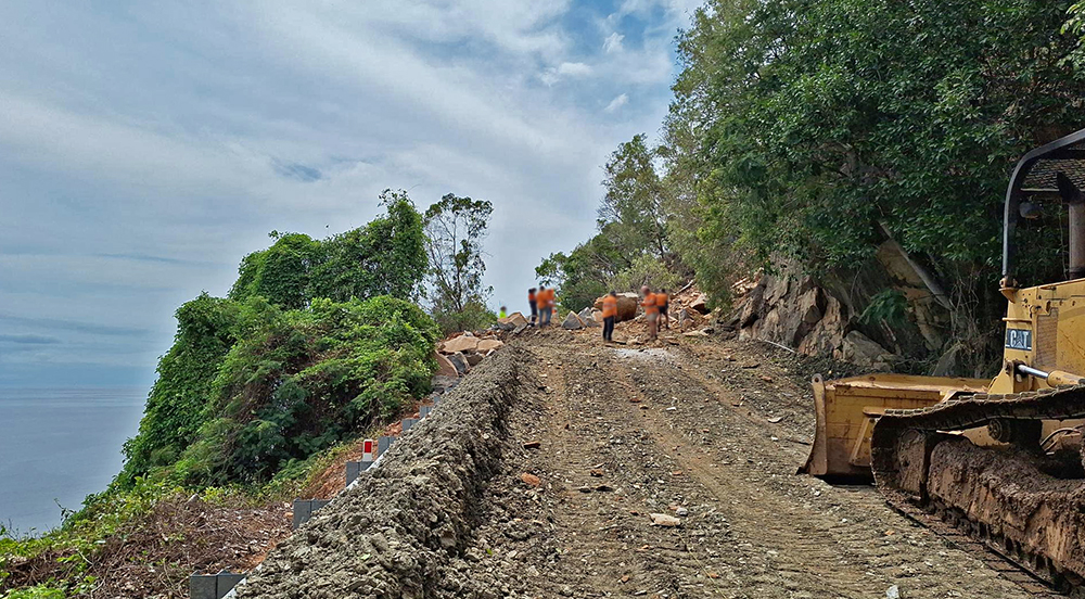
After the great boulder was eventually blasted (2023-12-22)
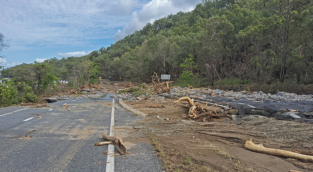
Cook Hwy destruction, double lanes north of Ellis Beach (2023-12-19)
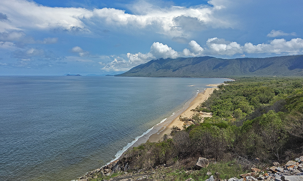
The calm after the storm, from Rex Lookout 10 days after TC Jasper (2023-12-23)

Smaller rock pile, 13 days after TC Jasper (2023-12-26)
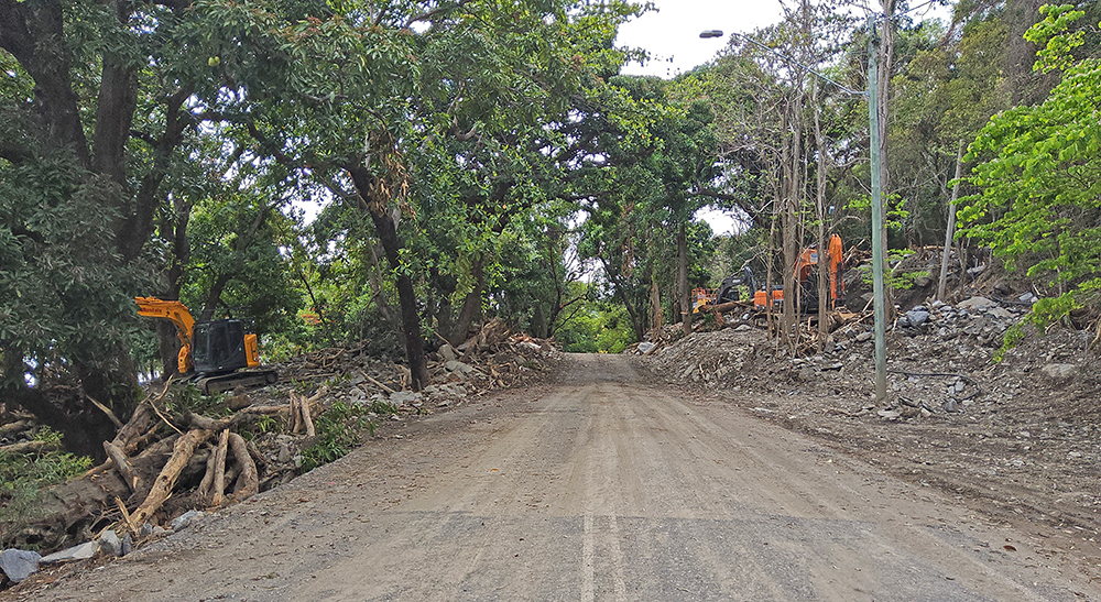
At Ellis Beach, with more than three quarters of the rock removed (2023-12-26)
VIDEO OF ELLIS BEACH FLOODING AND ROCKSLIDES
Video/Ellis_Beach_Flooding_And_Rockslides_01.mp4
Video/Ellis_Beach_Flooding_And_Rockslides_02.mp4
Video/Ellis_Beach_Flooding_And_Rockslides_03.mp4
Video/Ellis_Beach_Flooding_And_Rockslides_04.mp4
Video/Ellis_Beach_Flooding_And_Rockslides_05.mp4