


In 1770 James Cook and the crew of the H.M.S.Endeavour sailed into the waters adjacent to what is now Cairns and named it Trinity Bay, as he had arrived on Trinity Sunday. He was followed in 1820 by Philip King on the H.M.S. Bathurst, then in 1848 by Wickham and Stokes on the Beagle, Blackwood on the Fly and Stanley on the Rattlesnake.
In 1873 George Dalrymple sailed from Cardwell to the Endeavour River onboard the cutter "Flying Fish", accompanied by 26 men and another cutter, the "Coquette". His task was to explore all rivers and inlets, determine the quality of any adjacent potential agricultural land, and to assist the curator onboard with collecting botanical specimens. He named many of the rivers, mountains and ranges along the coast (including Macalister Range), and his well-armed crew, sent ashore to obtain fresh water and provisions at what is now known as Palm Cove, had one of the first confrontations with the local aboriginal Yirrganydji tribe.
Lying roughly midway between Cairns and Port Douglas, the Wangetti area remained largely untouched by Europeans until after the establishment of these two townships in 1876-77. From the 1850's, fishermen seeking Beche-De-Mer (Sea Cucumber) and Turtle Shell had travelled the nearby coast frequently, but usually made their camps on the offshore islands. Loggers in search of the valuable Australian Red Cedar, and other sought after cabinet timbers such as Kauri Pine, were present in the area as early as 1870, but had no way to get the lumber out of the forests and into ships at that stage.
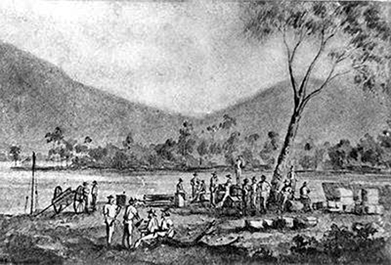
It was the official declaration of the Hodgkinson Goldfield and Minerals Area in June 1876 that precipitated the establishment of both Cairns and Port Douglas, as the miners at Thornborough in the goldfields were desperate for a good nearby port and a reliable track to service that port. Although Cardwell was well established by 1875, and had a good port and jetty, it was a considerable distance from the new goldfields, despite being used as a second port for the Palmer River goldfields. The same could be said for Cooktown, which had been established as a port for the Palmer River goldfields (Maytown) as early as 1873.
Pressure from both miners and prospective settlers was mounting on the Queensland Government and, after several initial surveying parties, the township of Cairns was established. At approximately the same time, the township of Port Douglas was also established and a race began to find the best and most suitable track between the towns and the new goldfields.
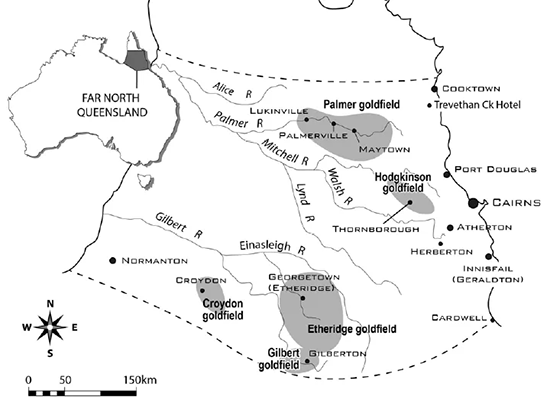
In 1876 two tracks had been forged between Thornborough and Cairns, Smith's Track was the first but was later overlooked in favour of the newer Douglas Track.
Both tracks had the drawback of a short, considerably steep section as they made their way up the mountains adjacent to the Barron River, however they were indeed quite usable and quickly found favour with both miners and suppliers. In the meantime Christie Palmerston, a well known local explorer, had discovered a route from Thornborough to Island Point (Port Douglas). The trail was cleared and became known as the Bump Track in 1877, predominantly because of the steep and bumpy section just west of the Mowbray Valley, called Slatey's Pinch.
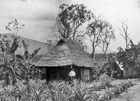
Both Cairns and Port Douglas soon rapidly increased in population. Many settlers arrived to try their hand at gold prospecting, but others just wanted farmland or the chance to source lumber from the nearby forests. A large number of Chinese became settlers at this time, some also prospecting, but many setting up market gardens or operating various trading stores.
Since the coastal mountain range was quite close to the coast for almost all of the area between Cairns and Port Douglas, it wasn't long before the only two open spaces, Mowbray/Spring Creek Valley and Wangetti Valley, became exploited.
After the establishment of Cairns, legendary bushman Christie Palmerston was asked to conduct a detailed survey of possible railway routes through the coastal ranges between Port Douglas and Innisfail. On 3rd June 1882, he named the “nice stream of water” he found at Hartley’s Creek after the Sub-Collector of Customs, Robert Hartley. He thought that the mountain range behind Hartley’s Creek was “the lowest gap in the range” and could offer “a splendid road all the way” to the tin mines at Herberton. The government owned but unopened Quaid Road now follows this route over the Macalister Range to the Atherton Tablelands.
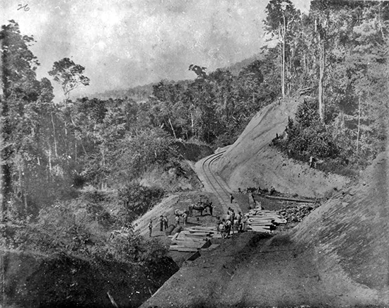
In 1882, following a severe wet season which cut off all major roads, tin miners in Herberton cried out for an inland rail line. In response, work began in 1886 to build a railway from Cairns to the Tablelands. After many setbacks, it was completed to Myola, west of Kuranda in 1891, but took until 1910 to actually reach the original destination of Herberton. This established Cairns as the predominant city in northern Queensland and its population began to steadily increase, leaving other towns to the north and south in its wake.
Tin and tungsten-bearing quartz were discovered at Hartley’s Creek in 1907 and a minor rush took place. There have been several periods of intensive prospecting since then, but the amount of tin produced has always been very small. During the depression years of the 1930s groups of farmers tried their luck without much success. Small-scale tin mining continued at Hartley’s Creek until the early 1980s. Miners and their families have made an important contribution to the township’s distinctive history and special identity.
Loggers and graziers also visited the coast during the early years of last century. Members of the well-known Veivers family hauled timber out of the coastal ranges with bullock teams and also ran herds of horses in the Hartley’s Creek area. With the help of Aboriginal men, they cut a track from Kuranda to Hartley’s Creek.
In 1930 the soon to be constructed Captain Cook Hwy was gazetted. It was to link, via a coastal route, Cairns with Port Douglas. Construction of the new Cook Hwy began at Buchan's Point in 1931 and the official opening took place at Hartley's Creek in 1933. The cost of construction had been higher than expected so a toll was introduced for all road users. Between 1938 and 1940, the highway was bitumenised through to Mossman (the highway had bypassed Port Douglas), and in 1946 the toll was abolished.
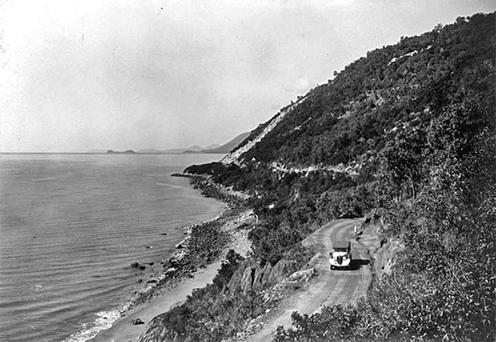
It is believed that the township of Wangetti (formerly Hartley's Creek) was named after one of the road workers - Ah Wang Eddy, a Chinese-South Sea Islander.
In 1934, another member of the road crew, Herb (Pop) Evans and his wife Mabel, opened a wayside teahouse and kiosk which was “a delight to travellers between Cairns and Mossman”. They called it The Halfway House, and it eventually became the Hartley’s Creek Zoo.
In 1935 Pop purchased a crocodile from Cairns and had it delivered to the kiosk, where he set it up as a tourist attraction. He named it "The Old Croc", but much later it became known as "Charlie" after one of the regular bus drivers who stopped there each day. Charlie eventually became world famous, with many international and local celebrities coming to visit.
Soon the highway became popular with visitors undertaking day trips from Cairns, and the Halfway House became a magnet for parties and social events. Pop and Mabel struggled on through the depression and World War II. Tourism increased after the war but the work was becoming too difficult. The kiosk was sold in 1954 to the Blaneys, who were the first of four owners over the next six years.
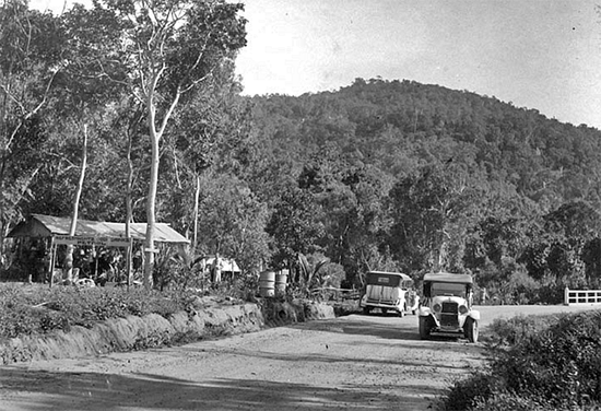
Hartley’s Creek Zoo was sold in 1961 to Gary Zillfleisch and family of Mossman. They had a long association with the business. Gary had learned all he could about crocs from old hunters and had travelled all over Cape York catching them. He found crocodiles hard to locate after years of shooting and became committed to their conservation. He decided to turn Hartley’s Creek into a ‘crocodile stud’ and raise them.
Hartley’s was the first place in Australia to breed crocs in captivity. Work on crocodile conservation and management attracted worldwide interest.
Television companies and film makers produced documentaries at Hartley’s which helped arouse public interest and sympathy. Calls for government intervention became too loud for politicians to ignore and in 1974 crocodiles were protected.
By now the zoo had established a venerable pedigree as one of North Queensland’s leading attractions. In 1986 it attracted the interest of, and was acquired by, the Freeman family, who were already involved in wildlife tourism with Wild World at Palm Cove. Renovated in 1987, the zoo remained at its original site until 2002 when the new Hartley’s Crocodile Adventures opened 500m south of Hartley’s Creek. The original site is now a private residence.
Prior to 1930, the population at Hartley's Creek was composed of a handful of tin miners, loggers and smalltime farmers. With the advent of the new highway, road gangs quickly bolstered the local population considerably. It was at this stage, and especially after Pop Evans started his roadside kiosk, that the township of Hartley's Creek began to stabilise.
The actual township of Wangetti was gazetted in 1936, with the 24 blocks to the east of the highway being offered up at auction under perpetual leases. Interest in the blocks was very low however and land sales didn't really commence until the early 1950's. Holiday shacks began to appear in the late 1960's, with proper houses arriving in the 1970's. Blocks on the west side of the highway became freehold after long periods of various leasing agreements.
The Home School was established in July 1977 on the land just NW of the Hartley's Creek bridge. It continued on through various name changes until becoming the present day Cape York Girl Academy.
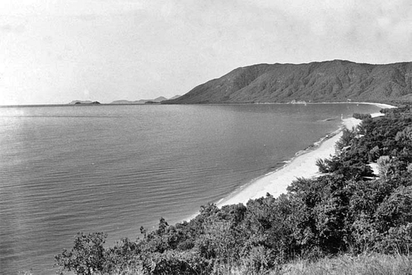
Please see the "Settlers" section in Wangetti Articles, Maps, and Photos for more content.